

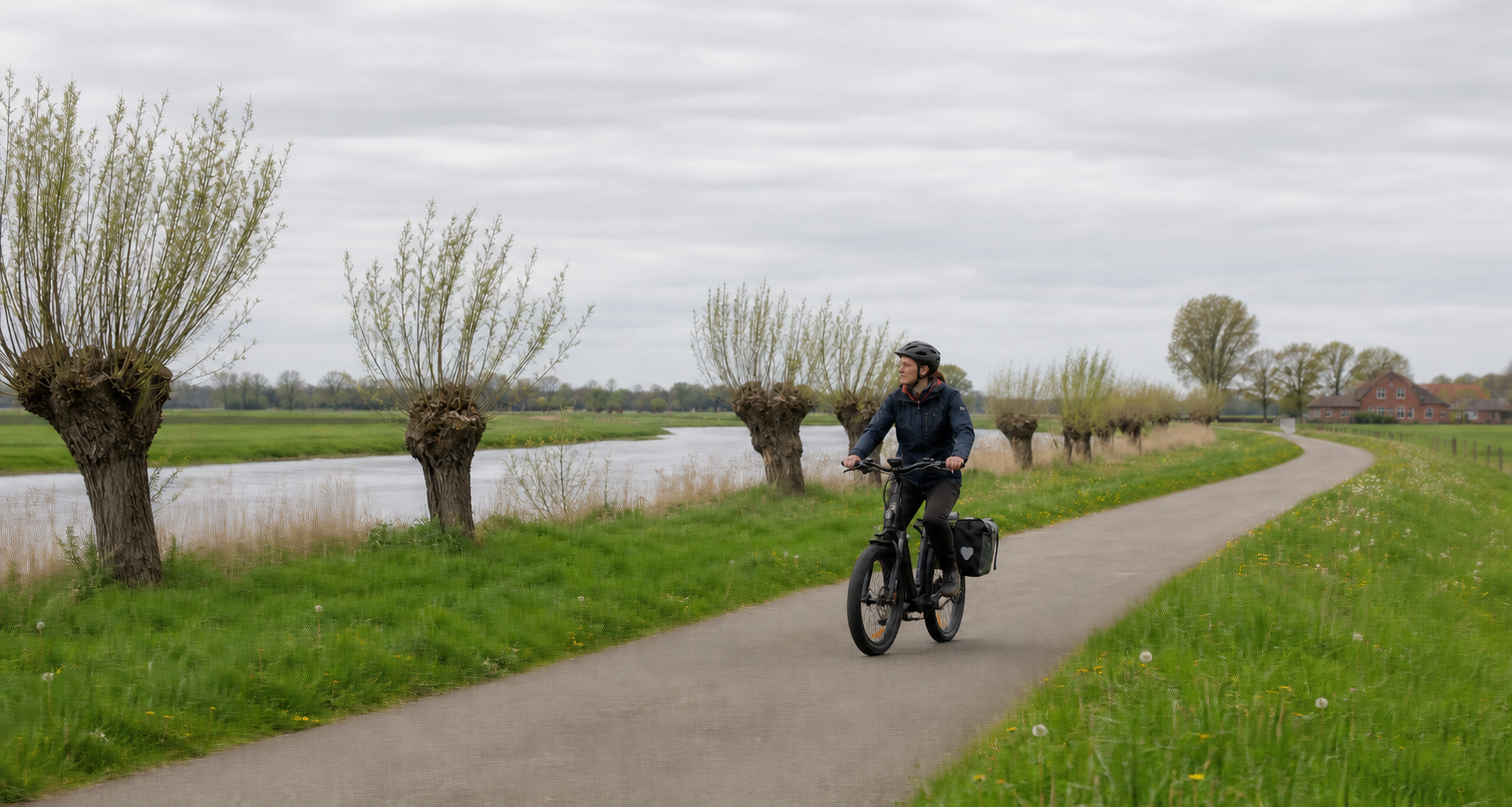
The EmsRadweg runs for approximately 385 kilometers from the Ems springs near Hövelhof to the Outer Harbor in Emden. It has hardly any significant climbs, runs mostly along quiet paths, and is well connected to the rail network. Nevertheless, a realistic eight-stage trip must take unpaved paths, wind, the temporarily limited availability of the Friesenbrücke, and the ferry service at Ditzum into account.
From the Senne to the North Sea
The official starting point is the Ems Information Center, Emser Kirchweg 84, 33161 Hövelhof. This is not the train station: Hövelhof is approximately seven kilometers from the starting point. Anyone getting off the train in Paderborn reaches the source via an additional connection. Two official pages give distances of around 20 and 25 kilometers, respectively. For planning purposes, the wording approximately 20 to 25 kilometers is therefore more accurate than a seemingly exact figure.
The route crosses the Paderborn region, the district of Gütersloh, Münsterland, the Emsland, and southern East Frisia. In protected areas, it deliberately moves away from the river. A travel description should therefore not promise that the Ems is constantly visible. Viewpoints, river crossings, and towns along the route instead provide recurring contact with the river.
Eight stages with short buffers
The official “Leisurely” option comprises ten travel days, nine overnight stays, and eight cycling stages of approximately 40 to 60 kilometers. The table below uses these stage locations. The exact distance for each day should be determined before departure using the current GPX file and taking any possible diversions into account.
| Day | Stage | Planning area | Note for the day |
|---|---|---|---|
| 1 | Hövelhof–Rheda-Wiedenbrück | approx. 40–60 km | Allow time to reach the Ems Information Center; starting in Paderborn results in a significantly longer first stage. |
| 2 | Rheda-Wiedenbrück–Warendorf | approx. 40–60 km | Check the current routing in the Warendorf area; diversions were reported there in 2026. |
| 3 | Warendorf–Emsdetten | approx. 40–60 km | Unpaved paths can be slower after rain; do not base travel time solely on asphalt speeds. |
| 4 | Emsdetten–Emsbüren | approx. 40–60 km | Rheine is an important rail and supply stop along the corridor. |
| 5 | Emsbüren–Meppen | approx. 40–60 km | Follow the information at the Gleesen lock and replenish supplies in the larger towns. |
| 6 | Meppen–Dörpen | approx. 40–60 km | Wind can noticeably extend the flat route; with an e-bike, do not plan on the maximum range. |
| 7 | Dörpen–Leer | approx. 40–60 km | Check the Friesenbrücke and the signposted alternatives between Papenburg and Leer on the same day. |
| 8 | Leer–Emden | approx. 40–60 km | Clarify the riverside routing and the Ditzum–Petkum ferry in advance; allow extra time for the train from Emden. |
Stops among half-timbered buildings, technology, and harbors
The first stages pass several places that are worth a short stroll. Rietberg has a historic center with many restored half-timbered buildings. Rheda-Wiedenbrück combines two old-town areas with Rheda Moated Castle, while Warendorf combines a historic old town with its equestrian tradition. These stops fit the shorter stages, but should not all be squeezed into a single day. Cobblestones and urban traffic are not included in the cycling route’s average speed.
Further along, Rheine offers a peaceful cultural stop at Bentlage Monastery. In the Emsland, you will come across the old towns of Lingen and Meppen, the museum harbor in Haren, and Papenburg with the Meyer Werft shipyard. Anyone planning a shipyard tour needs a confirmed booking and additional time. The Ems barrage near Gandersum can be viewed from the southern bank at Nendorp via a short detour; reaching the visitor center on the north side requires factoring in a ferry and additional kilometers.
Farm cafés and farm shops supplement provisions but do not replace food for the day. In Emsbüren, Enkings Mühle with pumpernickel is one possible stop; in the Emsland, Melkhüskes can be found along the route; and in the north, East Frisian tea and matjes are part of the regional cuisine. Check opening days and card payment options in advance. This way, such breaks remain a bonus rather than becoming a risk on a poorly supplied section.
The two additional travel days can be used as an arrival day in Hövelhof and a departure day in Emden. This means a delayed train connection does not have to be combined with a long first or final stage. Those with less time can also find a classic six-stage version with around 60 to 80 kilometers per day from the official provider, as well as a sporty five-stage version with around 75 to 90 kilometers. These plans require an appropriate level of fitness.
Surface: flat does not mean entirely paved
According to the official description, the EmsRadweg has no significant climbs. Most of the route runs along paved agricultural roads. However, roads in European protected areas often may not be paved; there, you will find water-bound surfaces. Some forest sections run along classic forestry roads.
A touring or trekking bike with sturdy tires is a good fit for this mix. Pedelecs are expressly suitable. The official portal advises against using a road bike with narrow tires and rims. Even on a flat route, loose gravel, wet leaves, cattle grids, or uneven surfaces may require attention. After rainfall, braking distances increase, and an unpaved section takes more time.
Recognize signage
The EmsRadweg is signposted in both directions. In North Rhine-Westphalia, the signs belong to the red-and-white regional system; in Lower Saxony, to the green-and-white system. The current route symbol shows a green wave with blue lettering. Since 2024, it has been gradually replacing the former green double-E; some old signs may still be present.
Where several themed routes use the same road, look for the small inset sign with the EmsRadweg symbol. Direction signs often show only an arrow and a bicycle symbol. In built-up areas, posts may stand on the opposite side of the road. An offline-saved GPX track is therefore useful despite the good signage.
E-bike and family: choose suitable stages
The low elevation profile makes the EmsRadweg accessible to many e-bike travelers. Headwinds in the north, luggage, and natural-surface paths can nevertheless increase energy consumption. A range reserve is planned for each daily section. Before booking, check with the accommodation whether secure storage and an approved charging facility are available.
For families, the eight-stage version is more suitable than the sporty packages. However, “no significant climbs” does not automatically mean child-safe. River crossings, local traffic, construction sites, and ferry approaches must be assessed individually. Each stage is selected so that a railway station or larger town remains reachable as a potential endpoint if the ride has to be cut short. With a trailer, narrow construction-site passages and train capacities should be checked in advance.
Rail connections along the route
According to the portal, more than 25 railway stations are located along or near the route. Regular services operate particularly along the Bielefeld–Münster and Münster–Emden lines. Important places include Rheda-Wiedenbrück, Warendorf, Telgte, Greven, Emsdetten, Rheine, Emsbüren, Lingen, Meppen, Lathen, Dörpen, Papenburg, and Leer. Hövelhof is on the Bielefeld–Paderborn connection.
The proximity to the railway provides a good Plan B, but does not guarantee space for bicycles. The operator, train type, and replacement-service timetable must be checked for current information. On rail replacement services, bicycle carriage is often restricted or excluded. Groups and bicycles with trailers should not plan to take the last connection of the day.
Friesenbrücke and Ditzum ferry
On the Papenburg–Leer section, the Friesenbrücke remains a dynamic point. The official detour page currently states that it may be used only on weekdays within a limited time window. Another official detailed notice showed different minute values. Therefore, no time is deliberately repeated here: the current notice and the signs on site are authoritative. The alternatives on both sides remain signposted.
The Ditzum–Petkum ferry connects both sides of the Ems and carries bicycles. A summer timetable is available for 2026; a current notice again states that it operates daily. Wind, weather, or technical issues may nevertheless change the timetable. Anyone needing the ferry for the final stage should check the operator's status and departures on the day of travel and have an alternative ready.
Accommodation and supplies
The official stage towns are also the most practical places to stay overnight. Rheda-Wiedenbrück, Warendorf, Rheine/Emsdetten, Lingen/Emsbüren, Meppen, Papenburg, Leer, and Emden offer rail connections, shopping, and dining. Bett+Bike accommodations may offer a lockable bicycle storage room and cycling-specific services; the specific services are confirmed before booking.
In natural and dyke sections, an open café is not always within reach. Water, a snack, and basic puncture-repair supplies are therefore essential equipment. For May to September, advance booking is advisable due to the typical cycling season. This period is a practical recommendation, not a statement about guaranteed weather or continuous opening hours.
Current diversions in 2026
Research status: September 3, 2026. The official website contains information on the Friesen Bridge, Emsseepark and other areas in Warendorf, Gleesen Lock, and Haren City Harbor.
The official route information must be checked again 24 to 48 hours before departure. An additional check on the day of travel is required for the Friesen Bridge and the Ditzum ferry. On site, the signposted diversion takes precedence over the regular GPX.
Official GPX and route planning
The official download area contains the complete track in both directions, as well as GPX files for longer-term diversions. The portal updates the route regularly; short-term construction works may nevertheless be more recent than the file.
The article links to the files only via the official website. It neither copies nor embeds the map, track, or photos. The terms of use restrict texts and images to private use and do not permit general commercial reuse. A separately licensed data source is therefore required for any independently published map.
Departure checklist
- Start at the Ems Visitor Center and include the additional access route from the railway station.
- Save the current GPX offline in the correct direction of travel.
- Check the Friesenbrücke, detours, and rail traffic 24 to 48 hours in advance.
- Check the Ditzum–Petkum ferry on the day of travel if it is part of the route.
- Allow for sufficiently wide tires and extra time on unpaved trails.
- Confirm charging facilities and bicycle storage with every accommodation provider.
Conclusion
The EmsRadweg is an easily accessible long-distance cycle route, but not a continuously asphalted riverside boulevard. Eight stages provide enough flexibility for unpaved trails, rail connections, and the changing situation around Papenburg–Leer. Anyone who checks current updates and does not make the final stage dependent on a single ferry departure will have a reliable plan from the source to Emden.
Sources and current planning
- EmsRadweg: Route – length, course, surface, suitability, start, and destination; checked on September 3, 2026.
- EmsRadweg: “Relaxed” tour option – ten days and eight stages.
- EmsRadweg: Signage – regional signs, new logo, and GPS notice.
- EmsRadweg: Getting there and departing – rail connections and distance to the starting point.
- EmsRadweg: Current detours – Friesenbrücke and local construction works.
- EmsRadweg: Ditzum–Petkum – current ferry notice and timetable access.
- EmsRadweg: Legal notice and copyright – limits on reuse.
- Germany’s Top River Routes: EmsRadweg – secondary thematic overview; the official EmsRadweg portal is authoritative for stations, stages, and current bridge conditions.
- RiverRoutes: Cities, industrial heritage, and regional cuisine – suggestions for stops and supplies, cross-checked against the official town and route websites.
Note: Stage figures are planning ranges. Current signage and notices from authorities, rail operators, and ferry services take precedence over this article and any saved GPX file.
Share:
Römer-Lippe Route in 6 stages: Detmold to Xanten
Danube Cycle Path in 12 stages: from Donaueschingen to Passau