

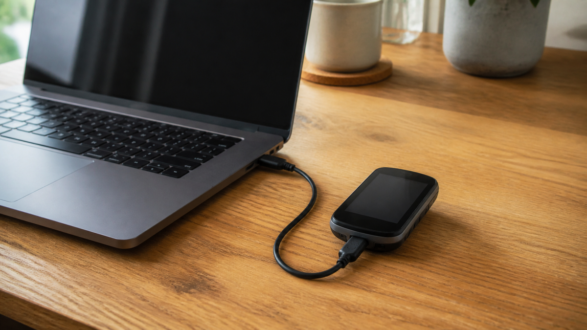
The tour has been downloaded, and the GPX file is in the Downloads folder. Even so, two steps remain before setting off: It must be placed in the appropriate section of the navigation software and then checked on the device that will actually accompany you. A message such as “Import successful” does not yet confirm that the route is unchanged or that the route may currently be used.
This process helps you import an existing cycling tour. Menu names may vary depending on the app, operating system, and device. It is therefore also essential to consult the instructions for your specific bike navigation device. This applies to e-bikes as well: A GPX function on a separate navigation device does not mean that the e-bike display supports the same file.
1. Store the original file clearly
Download the tour from the official route website whenever possible. Note the source and download date. Keep the unmodified file and work with a copy if you want to adjust the route. This makes it possible to determine later whether a deviation was already present in the original file or occurred during import.
A clear name is more useful than several files called “Tour.” Our suggestion: region, stage, and version date, for example, “ExampleRegion_Day2_2026-09-07.” This is only a naming example, not a real route. Keep your final version separate from older drafts before transferring files to the navigation device.
2. Choose the right import for a future ride
| What you want to do | What you should check | What should be visible afterward |
|---|---|---|
| Follow a downloaded tour | Import it as a planned route or course, not just as a completed activity | The tour can be selected for navigation |
| Modify a template before the trip | An editable copy and the appropriate cycling profile | Your own clearly named version |
| Use the tour on a separate navigation device | The device’s compatibility and designated transfer method | The route is also available on the navigation device |
| Archive a tour you have already completed | Import it into the activity or tour history | An entry in the correct archive section |
A specific example is GPX import in komoot: On the website, open your saved tours, select GPS file import, and then choose import for route planning. Next, select the sport and save the tour under a recognizable name. Importing it as a completed tour serves a different purpose. Check the current help text for supported formats and any required access.
In Garmin Connect, GPX files can be imported as courses. On the web, go through Training and Planning to Courses and Import. After selecting the course type, name, and saving, transfer it to a compatible device. Saving it to your account and sending it to the device are therefore separate steps. Use the instructions for your particular model for the final step.
3. Compare the original and imported route
First look at the entire route, then zoom in on the key sections. Our checking process consists of four comparison points: the start, the destination, a prominent intermediate location, and a sensitive connection, such as a river crossing. For a loop route, also check the direction of travel and the section where the outbound and return routes run close together.
- Does the tour begin at the intended starting point or at a distant endpoint?
- Are all stages and loops present?
- Does the tour cross the same bridge or use the same ferry as the original?
- Are there surprisingly straight connections between points that are far apart?
- Does the displayed total distance differ significantly from the original?
Deviations are a reason to investigate, not automatic proof of a defect. In komoot, adapting the route to known paths can change its course. Conversely, anyone who retains the original route may encounter sections outside the known road network, where navigation is less accurate. Compare both displays before accepting a recalculated route.
4. Open the completed tour on the bike navigation device
Use the method intended for your device, such as a connected manufacturer app or an explicitly described cable import. Do not transfer files to several folders as a precaution. Then open the course list directly on the navigation device and check the name, route, and distance. Only this check confirms that you have not merely saved a file on the computer.
With a cable connection, the plug and port are also part of the preparation. For example, in the Edge 840 manual, Garmin advises carefully drying the port, protective cap, and surrounding area before connecting the device. Use a suitable data cable and do not force a connection with an incompatible plug. The folder structure of another navigation device is not a reliable guide for your own model.
Test your preparations the day before if possible: open the tour, locate the starting point, and check the map view. If your navigation is meant to work offline, the required data must be available according to the instructions. A GPX file and a downloaded background map are not the same thing. For example, komoot exports only the route geometry, not its maps or voice instructions.

5. On site, current notices and closures remain decisive
A technically successful import does not authorize you to use a route. A practical example illustrates this: The operators of the RuhrtalRadweg explain that temporary diversions are not consistently included in the GPX files. Check the current notices from the respective route operator shortly before your tour and follow the signs on site.
If the file and the situation do not match, stop in a safe place. Check the next permitted connection instead of following a line through a barrier. A technical shortcut in the app answers neither the question of access rights nor that of the condition of the surface.
Frequently asked questions about GPX import
Why can’t I find the imported tour on my navigation device?
First check whether it has only been saved to your account or has already been sent to the correct device. Also check the import section: An archived activity is not automatically a selectable navigation course.
Can I operate every bike navigation device in the same way?
No. File formats, import menus, and transfer methods depend on the model and its software. Use the device’s official instructions. Renaming a file extension does not replace format conversion.
Is GPX import always free?
There is no blanket answer to this. For the service you choose, check separately which conditions apply to import, export, maps, and navigation. This guide does not require any specific paid package.
Is a successfully imported GPX file enough before setting off?
No. Compare the route, open the tour on the device you are carrying, and check current route notices. Only then is the digital preparation complete; weather and conditions on site must also be assessed.
The useful conclusion is therefore not the import message, but a checked tour on your own navigation device. Keep the source, name your final version, and check the critical transitions. This takes little effort at home and makes orientation easier on the road.
Information as of September 7, 2026. Software interfaces and terms of use may change. The illustrations are for explanation only and are not intended as navigation templates.
Share:
Cycling holiday with a fixed base: day trips instead of changing hotels
Cycling holiday with a fixed base: day trips instead of changing hotels