

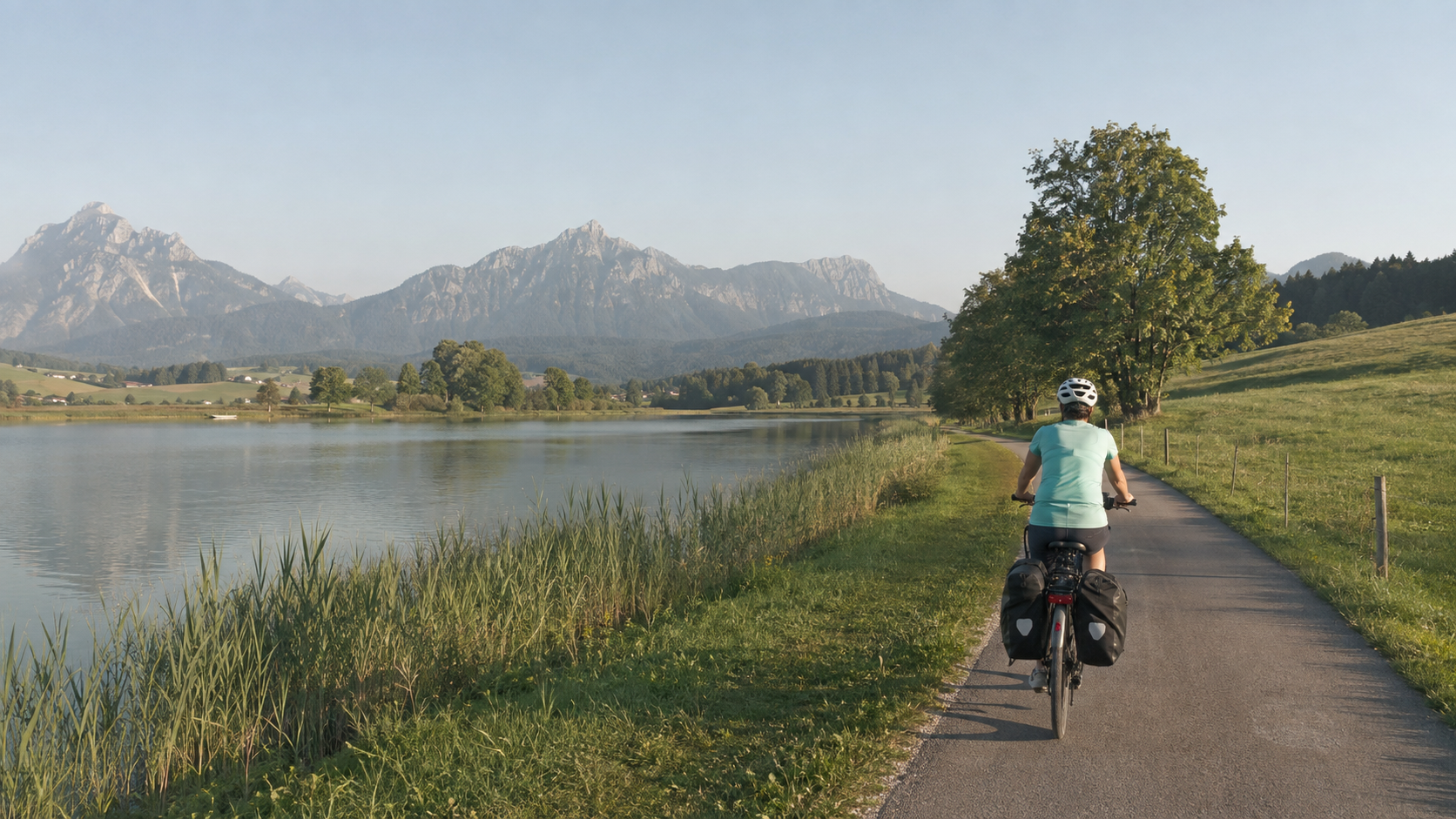
In short: The Lake Constance–Königssee Cycle Route connects Lindau with Schönau am Königssee over 455 kilometres. This seven-day itinerary follows the official distance table and divides the route into 40 to 77 kilometres per day. It suits endurance-oriented touring cyclists and e-bike riders who consciously manage their energy even on long climbs.
The name sounds like a leisurely lake tour. In reality, the route constantly goes up and down along the northern edge of the Alps. The official publisher states 4,370 metres of elevation gain, around 395 kilometres of asphalt, and approximately 60 kilometres of gravel and natural surfaces. The route is signposted in both directions. For planning purposes, Lindau–Schönau is usually more convenient: you start at Lake Constance, ride east through the Allgäu and Upper Bavaria, and arrange your return journey from Berchtesgaden.

The route at a glance
| Feature | Planning figure |
|---|---|
| Start and finish | Lindau on Lake Constance – Schönau am Königssee |
| Total distance | 455 km according to the current official distance table |
| Elevation gain | around 4,370 m of climbing; measurements may vary depending on the track, device, and version |
| Surface | approx. 395 km of asphalt, approx. 60 km of gravel and natural surfaces |
| Duration of this itinerary | 7 riding days, 40–77 km per day |
| Difficulty | technically mostly easy, but physically demanding due to many climbs |
| Recommended travel period | usually May to October; check the weather, wet conditions, and the possibility of early snowfall |
The figures come from the official route brochure and the distance table. They are planning figures, not a guarantee of your daily mileage. Routes to the train station, accommodation, and sights are additional.
Lake Constance–Königssee Cycle Route in 7 stages
| Day | Section | Distance | What you should keep in mind |
|---|---|---|---|
| 1 | Lindau – Immenstadt | 65 km | Hilly opening section through the western Allgäu; do not start too fast. |
| 2 | Immenstadt – Füssen | 72 km | Via Sonthofen and Oy-Mittelberg; plan for long climbs and an energy reserve. |
| 3 | Füssen – Murnau | 74 km | Many destinations along the way, but little time for extended sightseeing. |
| 4 | Murnau – Bad Tölz | 40 km | Shorter recovery day with reserves for bad weather or a breakdown. |
| 5 | Bad Tölz – Bad Feilnbach | 65 km | Via Tegernsee and Schliersee; repeated climbs and descents. |
| 6 | Bad Feilnbach – Traunstein | 77 km | The longest day in this itinerary; set off early and plan your breaks. |
| 7 | Traunstein – Schönau am Königssee | 62 km | Allow enough time for the final climbs and the ride to your destination. |
Day 1: Lindau – Immenstadt, 65 km
Plan to spend the previous evening in Lindau if your train journey is long. That way, you will not have to begin the first climb in the Allgäu under pressure from delays. The landscape quickly becomes hillier beyond Lake Constance. Pace yourself and refill your water before reaching smaller towns. Immenstadt is a practical stage destination because the official table makes a clear break here, allowing you to continue directly the next morning.
Day 2: Immenstadt – Füssen, 72 km
The route first passes through Sonthofen and then climbs toward Oy-Mittelberg. This day is determined less by technical sections than by repeated elevation gains. On an e-bike, you should select a low assistance level on long climbs and check the remaining battery level against the distance left by lunchtime at the latest. Do not rely on finding a public outlet spontaneously.
Day 3: Füssen – Murnau, 74 km
There are well-known cultural and scenic destinations between Schwangau, Wildsteig, and Murnau. With seven riding days, you have to choose: a long castle visit or an extended detour will significantly change the day's plan. The official distance is 74 kilometers, with additional distance for access roads. Nature trails may be slower after rain; wide, puncture-resistant touring tires are more practical than pure road-bike tires.
Day 4: Murnau – Bad Tölz, 40 km
The shortest day is not a wasted day. Use it as a buffer: start later, dry your clothes, check the brakes and tires, or check in earlier in Bad Tölz. Especially on a route along the Alpine foothills, a planned lighter day is better than seven consistently demanding stages. Even if the section seems more moderate overall, headwinds and weather can still affect your timing.
Day 5: Bad Tölz – Bad Feilnbach, 65 km
The route runs through the Alpine foothills via Tegernsee and Schliersee. Short climbs add up. Start with a fully charged battery, bring your own charger, and only arrange a midday charge where the operator explicitly agrees. If you are riding without motor assistance, plan an additional food break. In heavy rain, descents, gravel, and leaves may require more concentration.
Day 6: Bad Feilnbach – Traunstein, 77 km
The longest stage leads to Traunstein via Neubeuern, Aschau, and the Chiemsee area. Start early and treat detours as an option, not an obligation. Swimming or taking a boat trip only makes sense if the weather, pace, and latest arrival time align. Book your accommodation in advance: at 77 kilometers, searching spontaneously in the evening is an unnecessary risk.
Day 7: Traunstein – Schönau am Königssee, 62 km
The final day takes you via Anger and the Berchtesgaden area. Do not expect to board a long-distance train directly at Königssee. The official travel information names Berchtesgaden, Freilassing, or Salzburg as stations for the return journey. Plan the transfer from the destination to your chosen station and check in advance whether your specific connection carries bicycles.
Arrival, return journey, and GPX
The starting point can be reached by train via Lindau. At the destination, the practical rail connection is in Berchtesgaden; depending on the connection, Freilassing or Salzburg may also be options. The official arrival and departure page expressly warns that taking a bicycle must be checked in advance. A bicycle space is not available on every train and is not automatically guaranteed.
Download the official GPX track before departure. The available data is from May 2025, so supplement it with the current signage and route updates. Save the map and booking details offline. A power bank does not replace the drive battery, but it helps with smartphone navigation.
Choose accommodation and charging wisely
In each of the seven destinations, look for accommodation with a lockable, dry bicycle storage room. For an e-bike, you also need an explicitly confirmed charging option at a standard, safe power outlet. Ask about the charging location, access hours, and house rules before booking. Bring the appropriate original charger and do not charge in escape routes or with damaged extension cords.
An establishment displaying the “Bett+Bike” designation can be a good starting point, but a seal does not replace a specific inquiry about your dates. For the high season and weekends by the lake, you should arrange the seven overnight stays early. Flexible cancellation is valuable because thunderstorms, heat, or a closure may shift your plans.
Preparation: Short checklist
- Check the brake pads, tires, chain, and lights before the tour.
- Save the official GPX track and an offline map.
- Pack a rain jacket, a warm layer, and sun protection.
- Take two ways to stay hydrated and high-energy emergency provisions.
- Pack a charger, a small repair kit, a spare inner tube, and a pump.
- Check and reserve bicycle transportation separately for the outbound and return journeys wherever required.
- Book accommodation with secure bicycle storage and confirmed charging facilities.
- Check the weather, warnings, and current detours the evening before.
Current route conditions and season
On September 4, 2026, the operator reported another railway crossing closure for Hergatz, expected from September 30 to October 8, 2026. A temporary detour is to be set up; the footbridge over the tracks is narrow and may be slippery when wet. Additional short-term closures may occur. Therefore, immediately before setting off, check the official route information and follow the signposted detours on site.
May to October is a useful general guideline, but not a guarantee that the route will be rideable. In spring, wet conditions and cool higher elevations can slow you down; in summer, heat and thunderstorms are relevant; at the end of September and in October, days become shorter and mornings colder. The decisive factors are the forecast and local information for your actual travel dates.
FAQ
Is the Lake Constance–Königssee Cycle Route suitable for beginners?
Technically, the route is mostly straightforward, but it is not easy in terms of fitness. For the seven-day version, you should be able to ride 60 to 75 kilometers with climbs on several consecutive days. An additional day of riding significantly reduces the pressure.
Can I ride the route with an e-bike?
Yes, if the range, total weight, tires, and brakes are suitable for the daily stages. Check the specifications of your specific bicycle and plan charging conservatively. This route is not a range test.
Which direction is better?
Both directions are signposted. Traveling from Lindau to Schönau simplifies this planning and ends at the Königssee in a particularly striking landscape. However, the direction does not eliminate wind or climbs.
Do I need a reservation for my bicycle on the train?
That depends on the train. Check each connection in the DB or regional transport information service and note any reservation and ticket requirements. Especially on long-distance services and weekends, you should not rely on spontaneous bike transportation.
Do I have to stay overnight in the exact location mentioned each day?
No. The division is an editorial proposal based on the official distance matrix. You can shorten it or add an extra day. What matters is that the accommodation, rail connections, and range suit your version.
Share:
Spree Cycle Route in 2 Days: Lübben–Beeskow–Erkner
Adjust your bike helmet correctly: How to check the fit