

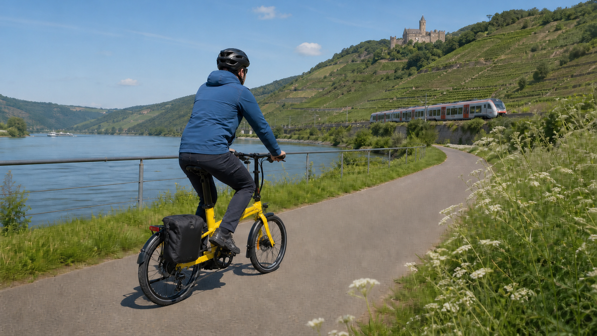
EuroVelo 15 – the Rhine Cycle Route connects Andermatt with Hoek van Holland. The current official portal lists 1,450 kilometers through six countries. However, these two figures alone are not sufficient for reliable trip planning: alternatives on either bank, the alpine opening section, ferries, and construction work determine how long and challenging your own ride will actually be.
1,450 kilometers or D-Route 8: What is meant?
The 1,450 kilometers refer to the current international EuroVelo 15 route. Older guidebooks, and even the page title in some search views, still mention 1,233 kilometers and four countries. These figures no longer match the current portal. Since 2025, the route has included, among other things, a 62-kilometer signposted section along the right bank of the Rhine through Liechtenstein and Vorarlberg. Anyone using an old GPX file may miss this extension.
The D-Route 8 “Rhine Route”, on the other hand, is Germany’s national long-distance route. It lies entirely along the Rhine Cycle Route and is largely marked with the D-route sign in Germany. It includes neither the start in the Swiss Alps nor the Dutch finale to the North Sea. Therefore, the international length of 1,450 kilometers must not be stated as the length of D8. For a trip entirely within Germany, the Germany Cycle Route Planner is the appropriate supplementary source; for the continuous six-country tour, the current EuroVelo track remains authoritative.
Even 1,450 kilometers is not a guaranteed figure for the bike computer. The Rhine Cycle Route uses both banks in sections and includes variants. Detours to accommodation, city visits, ferry terminals, and diversions add to the total. Therefore, plan with a distance range and calculate your chosen route only after deciding which bank to use in the current GPX file.
The seven official major sections
EuroVelo divides the route into seven large areas. These are orientation zones, not binding daily stages:
| No. | Official corridor | Key planning question |
|---|---|---|
| 1 | Source of the Rhine – Lake Constance | Snow conditions, alpine experience, and the new route through Liechtenstein/Vorarlberg. |
| 2 | Lake Constance – Basel via the Rhine Falls | Choice of riverbank between Germany and Switzerland, as well as rail replacement services on the Upper Rhine. |
| 3 | Basel – Karlsruhe through Alsace and Baden | Border crossings, accommodation, and longer flat daily stages. |
| 4 | Karlsruhe – Bingen | Urban traffic, wine towns, and the choice between the two sides of the Rhine. |
| 5 | Bingen – Cologne via the Middle Rhine | Right-bank gap, narrow road sections, and rail construction sites. |
| 6 | Cologne – Arnhem | Conurbations, port traffic, and cross-border rail planning. |
| 7 | Arnhem – North Sea through the Rhine Delta | Leisure ferries, wind, and the hills around Veluwe/Utrechtse Heuvelrug. |
For sightseeing, a few well-spaced stops make sense: Lake Constance and the Rhine Falls in the south, Strasbourg on the Upper Rhine, wine towns and castles between Mainz, Bingen, and Koblenz, as well as Cologne and Duisburg's inner harbor farther north. In the delta, Kinderdijk can be included only with deliberate route and ferry planning. These places are time blocks, not additional stages without mileage.
Editorial proposal: 25 riding days
This breakdown is an editorial plan, not an official stage list. The guidelines were derived from the official GPX file dated September 3, 2026. They assume a loaded touring bike or e-bike, regular cycling experience, and usually 45 to 80 kilometers per day. Choice of riverbank, feeder roads, and detours alter the final figure.
| Days | Overnight stay sequence | Guideline | Practical details |
|---|---|---|---|
| 1–5 | Andermatt – Disentis/Mustér – Chur – Vaduz – St. Margrethen – Constance | approx. 32–65 km/day | Keep day 1 deliberately short; on days 3 and 4, choose the new route along the right bank of the Rhine through Liechtenstein and Vorarlberg. |
| 6–8 | Constance – Neuhausen am Rheinfall/Schaffhausen – Bad Zurzach – Basel | approx. 49 / 51 / 70–77 km | Allow time for the Rhine Falls; because of the Hochrhein Railway, do not rely on being able to take your bicycle spontaneously on a replacement bus. |
| 9–11 | Basel – Breisach/Neuf-Brisach – Strasbourg – Karlsruhe | approx. 58–65 / 72 / 86 km | Determine which side of the border to use before booking accommodation; carry identification, a suitable mobile phone plan, and a repair reserve. |
| 12–14 | Karlsruhe – Mannheim – Gernsheim – Mainz | approx. 80 / 53 / 45 km | Depending on the bank, the middle stage may be structured differently via Speyer or Worms; do not add both variants together. |
| 15–18 | Mainz – Bingen – Koblenz – Bonn – Cologne | approx. 33 / 65 / 73 / 36 km | Plan the section between Bingen and Koblenz on the left bank of the Rhine; short city days leave time for sightseeing and a traffic buffer. |
| 19–21 | Cologne – Düsseldorf – Wesel – Arnhem | approx. 57–61 / 75 / 78 km | Do not mistake industrial and port areas for a consistently tranquil riverside promenade; save the rail alternative in advance. |
| 22–25 | Arnhem – Amerongen – Gorinchem/Woudrichem – Dordrecht – Rotterdam/Hoek van Holland | approx. 48 / 71 / 47 / 73 km | Check the Gorinchem–Woudrichem connection and the other ferries operating that same morning; the final day runs via Rotterdam. |
With rest days in Basel, Strasbourg, Cologne or Rotterdam, this becomes 27 to 29 travel days. Anyone travelling with children, rarely cycling for several consecutive days or wanting to do plenty of sightseeing should not force the entire route into four weeks. It is more sensible in that case to choose a single official major section with rail connections at both ends.
Choosing a bank on the Middle Rhine
On many sections, you can switch sides of the Rhine via bridges or ferries. In the Upper Middle Rhine Valley, however, the choice is not symmetrical in 2026: on the right bank, there are still gaps in the cycle path between Kestert and St. Goarshausen. EuroVelo recommends the left bank there, or taking an excursion boat for part of the route. The route is rideable throughout on the left, but because of the narrow valley, it runs directly alongside the road or through built-up areas together with traffic in some places.
The practical consequence is this: do not book accommodation and luggage transport on different banks before the crossing has been confirmed. Ferries depend on the season, water levels and operating hours. A final ferry of the day is not a reliable Plan B.
Surface, gradient and signage
The current EuroVelo guide lists 1,287 kilometres as certified. Of this certified section, 73 percent is considered suitable for different types of bicycles and user groups. This does not mean that all 1,450 kilometres are flat, paved or suitable for families. The Andermatt–Breil/Brigels section is recommended only for experienced cyclists because of mixed road conditions and heavier traffic. The altitude and possible remaining snow also need to be taken into account.
Farther north, well-maintained cycle paths and flat river valleys predominate, but surfaces, urban sections, and signage vary between countries and regions. In the Netherlands, the Veluwe and Utrechtse Heuvelrug have noticeable rolling terrain. The EV15 sign is supplemented by national and regional numbers; in Germany, the D8 is important, and in Liechtenstein, the Rhine Valley Route 35. Offline navigation therefore remains useful, even when the signage appears good.
E-bike and family: choose suitable sections
An e-bike makes headwinds and long days easier, but it does not automatically make the alpine start low-traffic or technically safe. Range must be calculated with luggage, climbs, cold temperatures, and frequent changes in assist level taken into account. Ask every accommodation provider about a lockable storage room and an approved charging option; a power-outlet symbol on someone else’s map is not sufficient confirmation.
Families will find many suitable sections, especially around Lake Constance, the Upper Rhine, and the Lower Rhine. However, the official figure of 73 percent refers only to the certified section of the route and not to every child, trailer, or daily distance. For children, the plan should include short stages, a railway station as an early-exit point, and a low-traffic side of the river. Andermatt–Breil/Brigels and the gaps on the right bank of the Rhine in the Middle Rhine region are not a blanket recommendation for families.
Trains, ferries, supplies, and season
The main supply and accommodation hubs are Chur, Konstanz, Basel, Strasbourg, Karlsruhe, Mannheim, Mainz/Bingen, Koblenz, Bonn, Cologne, Düsseldorf, Duisburg, Arnhem, and Rotterdam. At least one shopping opportunity and one repair option should be marked for each day in between. In Germany, Bett+Bike; in France, Accueil Vélo; in Switzerland, SchweizMobil; and in the Netherlands, “Fietsers Welkom!” can help with the search. Availability and facilities must still be confirmed directly.
For the German section, the official guide identifies April to September as a good time to travel; the same applies to the Dutch finale. Anyone starting in Andermatt should wait at least until after the snowmelt in May and check the weather and pass conditions shortly beforehand. The increased search interest from May to August in Google Trends indicates planning demand, but neither good weather nor clear routes.
In 2026, two rail disruptions are particularly relevant: the High Rhine Railway between Rheinfelden and Erzingen is closed for several months due to upgrade works, and from July to December the right-bank Rhine line between Wiesbaden and Troisdorf will undergo major refurbishment. According to EuroVelo, bicycles cannot be carried on either of the replacement services mentioned. Check DB, SBB, SNCF and NS for the specific connection; bicycle tickets, reservations and permitted carriage times differ. In the Dutch delta, also check the current status of recreational ferries on the day.
Check the current situation in 2026 before every stage
- Open the EuroVelo country page and the relevant regional cycle route planner 24 to 48 hours beforehand.
- For Hesse, closures are incorporated into route calculations daily; in North Rhine-Westphalia, check the map and notices.
- Check the DB or regional timetable with the bicycle option enabled; do not assume that a replacement bus can carry bicycles.
- In the Netherlands, read the Rijnfietsroute notices and ferry timetables on the day of travel.
- After heavy rain, check the regional flood control centres and local authority notices.
- A signposted detour and an official closure take priority over a saved GPX track.
Official map, GPX and ODbL
EuroVelo offers a complete GPX download including sections under development, as well as a download of developed sections only. The official route planner helps with comparisons. Reload the track shortly before your trip; according to the licence notice, temporary detours may be missing.
The GPX data is licensed under the Open Database License. Anyone who publicly reuses it or creates their own map from it must comply with the licence terms, including attribution and, where applicable, sharing under the same terms. The required attribution, with today's retrieval date, is:
Contains information from EuroVelo GPX tracks downloaded from www.EuroVelo.com on 3 September 2026, which is made available here under the Open Database License (ODbL).
This post links only to the official offers. It does not copy or embed any map, logo, GPX file, or third-party photo. EuroVelo explicitly points out that ECF cannot grant blanket rights to the photos shown on the website. A later feature image therefore requires either an original image or a separately documented commercial licence.
Conclusion
The Rhine Cycle Route is very manageable as a six-country journey, provided that 1,450 kilometers are not mistaken for one continuous, identical route. The seven official major sections provide the framework; the 25-day proposal offers bookable intermediate destinations. What remains crucial is making a deliberate choice of riverbank, allowing extra time for trains and ferries, and rechecking GPX data, weather, flooding, and closures shortly before each stage.
Sources and current planning
- EuroVelo 15 – Rhine Cycle Route – current total length, countries, seven major sections, and GPX access; checked on September 3, 2026.
- EuroVelo: 2026 planning guide – suitability, season, riverside gap, rail works, and ferries.
- EuroVelo: 2025 extension – 62-km section through Liechtenstein and Austria.
- EuroVelo 15 in Germany – route, signage, and classification as D-Route 8.
- Germany Cycle Route Planner – national D-routes and regional routing.
- EuroVelo GPX License & Disclaimer – ODbL, attribution, and limitations on currency.
- Hesse Cycle Route Planner: roadworks and closures and Verkehr.NRW – current regional maps and notices.
- Nederland Fietsland: Rhine Cycle Route updates and Veerponten.nl – detours, signage, and ferry checks in the delta.
- Deutsche Bahn and cross-state flood portal – dynamic traffic and hazard checks.
- EuroVelo: Terms and Conditions – Copyright notice for photos and graphic elements.
As of September 3, 2026. Distances in the editorial itinerary are corridors. Current signage, official, operator, and traffic notices take precedence.
Share:
Neckar Valley Cycle Path in 8 Stages: Source to Mannheim
Moselle Cycle Route in 10 stages: from Perl to Koblenz