

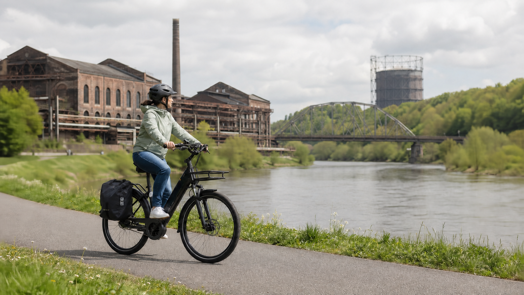
The RuhrtalRadweg follows the Ruhr from Winterberg to Duisburg. The official distance is around 240 kilometres. In terms of landscape, this is not a uniform river tour: Sauerland hills and short climbs shape the first kilometres of the day, followed later by Ruhr lakes, floodplains, half-timbered towns and industrial heritage. For 2026, it is particularly important to note that the saved GPX track does not include every short-term detour.
Route: from the Hochsauerland to Duisburg’s inner harbour
The official kilometre counter starts in Winterberg. The source of the Ruhr is at 674 metres, while the classic mouth into the Rhine is at 17 metres. Nevertheless, you do not simply roll 240 kilometres downhill. There are particularly several uphill sections during the first roughly 35 kilometres. After that, the route is predominantly flat. The route passes through Olsberg, Bestwig, Meschede and Arnsberg, passes Fröndenberg and Schwerte, and reaches the more densely populated western section via Hagen, Herdecke, Wetter, Witten and Hattingen, with Essen, Mülheim and Duisburg.
The destination information needs an addition in 2026: Due to long-term closures at the Karl-Lehr Bridge and Ruhr weir, the official route is currently being newly signposted and ends at the Buckelbrücke in Duisburg’s inner harbour. Anyone wishing to continue to the Rheinorange at the mouth of the Ruhr should use a separate route proposal from there. According to the route information, this connection is not marked with the RuhrtalRadweg logo.
The official division into six cycling days
The official tour proposal divides the route into six cycling days. The kilometre figures serve as a planning framework; access routes to accommodation, sightseeing and current detours come on top.
| Day | Official stage | Distance | Planning note |
|---|---|---|---|
| 1 | Winterberg – Olsberg | 20 km | Short, but with some steep sections; in 2026, note the detour at the B480. |
| 2 | Olsberg – Arnsberg | 52 km | Bestwig and Meschede lie in between as supply and rail hubs. |
| 3 | Arnsberg – Schwerte | 56 km | River floodplains and smaller towns; it is better to plan time for Arnsberg’s old town the previous evening. |
| 4 | Schwerte – Hattingen | 47 km | Check Lake Hengstey, Lake Harkort and Lake Kemnade, as well as the ferry crossing near Witten. |
| 5 | Hattingen – Mülheim | 47 km | Industrial heritage and Lake Baldeney; do not include detours in the pure route distance. |
| 6 | Mülheim – Duisburg | 18 km | Short final day; the current official endpoint is in the inner harbor. |
The official town-distance table places Olsberg at kilometer 25, while the six-day proposal gives 20 kilometers for Winterberg – Olsberg. This difference shows why stage distances should not be treated as meter-precise guarantees. For a specific booking, the current track, including the selected access route, is what matters.
In five or four stages: only as an editorial alternative
The following variants are editorial suggestions, not official stages. They use the cumulative town distances from the official portal. Construction work may change the daily distances.
For five days, Winterberg – Olsberg (approx. 25 km), Olsberg – Arnsberg (approx. 43 km), Arnsberg – Schwerte (approx. 57 km), Schwerte – Hattingen (approx. 50 km), and Hattingen – Duisburg (approx. 65 km) is a reasonable sequence. The final day is long; anyone wishing to visit Hattingen and the western Ruhr Valley will have a more relaxed ride with the official six-day division.
A four-day tour is challenging: Winterberg – Arnsberg (approx. 68 km), Arnsberg – Schwerte (approx. 57 km), Schwerte – Essen (approx. 77 km), and Essen – Duisburg (approx. 38 km). Especially in 2026, the construction situation argues against rigid target times. For families, occasional cyclists, or a trip with many museum stops, this compression is not advisable.
Which stops really define the route
The journey conveys the valley’s transformation better than a list of as many sights as possible. After the source of the Ruhr and the Sauerland, it is worth heading uphill into Arnsberg’s historic old town. Between Schwerte and Hattingen, the recreational landscape around the Ruhr reservoirs comes into view. In Witten, Nachtigall Colliery is close to the route; in Hattingen, the half-timbered old town and the LWL Museum Henrichshütte go hand in hand. At Lake Baldeney, a longer stop along the shore is worthwhile, while Zollverein Coal Mine should be included in the plan only as a separate detour with additional time. In 2026, the finale at Duisburg’s inner harbor fits the current route even better than a forced detour to the Rheinorange.
Surface, gradients, and signage
The official route statistics indicate approximately 50 percent of separately routed cycle paths away from roads, 30 percent forest service roads and minor urban roads, and 15 percent sections along main roads with cycling infrastructure. The published categories do not add up to 100 percent; no exact asphalt percentage should be derived from this. A touring bike, trekking bike, or e-bike with practical everyday tires is more suitable than a delicate road-racing setup.
The route uses the NRW cycle network with red-and-white signposts. At junctions, the RuhrtalRadweg logo appears as an inset below the destination signs. Neutral intermediate signs intentionally do not display a route logo and apply to all routes running along that section. At a construction site, the diversion marked on site takes priority over navigation.
E-bike and family: plan the limits honestly
An e-bike helps with the climbs in the Hochsauerland, but it neither eliminates traffic on a detour nor wet conditions on farm roads. With luggage, the range should cover the longest planned day plus a reserve. Charging points are listed in the official tour planner; their actual accessibility should be confirmed with the accommodation provider or restaurant. The weight and handling of a loaded e-bike are relevant for the ferry landing and any potential rail replacement service.
Since 2026, the portal has offered its own family tours. However, this does not automatically make the entire route family-friendly. The current section along the heavily trafficked B480 between Winterberg and Niedersfeld is clearly borderline for families. Anyone wishing to avoid it should follow the official recommendation and start in Olsberg during the construction period. In the lower Ruhr Valley, short day stages with a train station as an exit point are the more reliable option for family planning.
Trains, ferries, hotels, and campsites
Normally, RE 57 connects Dortmund with Winterberg without requiring a change. In the 2026 season, however, construction work will occur repeatedly; at times, trains have already terminated in Bestwig or Olsberg. Bicycle transport on replacement bus services is not guaranteed. Therefore, check the connection, bicycle option, and transfers shortly before departure with Zuginfo NRW and the transport company. Meschede, Arnsberg, Fröndenberg, Schwerte, Wetter, Witten, Essen, Mülheim, and Duisburg are useful rail or supply points, but they do not form one continuous return route.
The ruhrtalFähre Hardenstein near Witten closes a gap between Herbede Lock and Hardenstein Castle Ruins. It may pause at short notice when water levels are high. In addition, the usual alternative route via the Nachtigall Bridge is closed for an extended period in 2026. The operator’s daily traffic light status should therefore be part of the morning check.
The official accommodation directory lists hotels, guesthouses, and other Bett+Bike partners by stage location; campsites and motorhome sites are listed separately. Booking in advance is advisable for weekends and holiday periods. Especially in the Sauerland, mark shops and water stops before setting off rather than relying on restaurants being open at all times.
May to September is generally the most practical travel period. In the Hochsauerland, cool, wet days can also occur in spring; in autumn, daylight windows and ferry operations become more limited. Seasonal search interest from May to August is only a planning aid, not a guarantee of weather or passability.
Current situation in 2026: these five checks are mandatory
- Open the official route notices 24 to 48 hours before departure and check them again the evening before. Short-term diversions are not fully incorporated into the GPX track.
- For Winterberg–Niedersfeld, check the signposted route. The works are expected to continue in sections until the end of 2026; the B480 should not be equated with a quiet family route.
- For train journeys, check Zuginfo NRW and the specific timetable information with the bicycle option.
- Before Witten, check the ruhrtalFähre ferry signal; outside operating hours, do not assume that an old alternative route is available.
- After heavy rain, check the official flood diversions and water levels. Signage and closures take priority over the track.
On September 3, 2026, the official website also lists diversions or works in Bestwig, Arnsberg-Neheim, Wickede, at Hengsteysee, and at Baldeneysee. Some notices have an end date, while others do not. They therefore should not be permanently included in an offline map.
Official map and GPX: link rather than copy
The portal provides the current track on the Navigation and GPX page; the direct download is labeled with the year RuhrtalRadweg 2026. The Komoot track linked there comes from the official account. Tracks from other users may follow a different route.
The website permits downloads and copies of its content only for private, non-commercial use; no general permission for the commercial republication of tracks, maps, logos, or photos is stated. This article therefore uses only ordinary links and does not reproduce any file, map, or third-party image.
Conclusion
Six riding days provide the most balanced official framework for the RuhrtalRadweg. Four or five days work only with longer stages and less time for Witten, Hattingen, and the industrial heritage. In 2026, the saved map alone is not enough either: the start in Olsberg, train connection, ferry service, and temporary destination at Duisburg’s inner harbor must be confirmed immediately before the trip.
Sources and current planning
- RuhrtalRadweg: figures, data, facts – length, location kilometres, elevation profile, and types of paths; checked on September 3, 2026.
- Official six-day proposal – stages and distances.
- Current route information – construction sites, flooding, the Winterberg routing, and the destination in Duisburg.
- Getting there by train – RE 57, construction work, and restrictions on taking bicycles.
- Signage and ruhrtalFähre Hardenstein – route signage and ferry checks.
- Accommodation and campsites and motorhome pitches – official host directories.
- Legal notice and copyright – Limits on the use of website content.
As of: September 3, 2026. Distances for the four- and five-day options are editorial estimates. Current operator, authority, and on-site information takes precedence.
Share:
10 cycling routes in Germany: Which route is right for your short vacation?
Weser Cycle Route in full: eight stages to Cuxhaven