

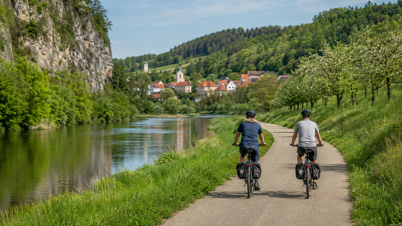
In short: The Kocher-Jagst Cycle Route is a circular tour starting in Aalen. The working group lists around 335 kilometers and six stages. You first cycle downstream along the Kocher to Bad Friedrichshall, then continue along the Jagst back toward Aalen. This breakdown uses the official stage locations and makes the return journey particularly easy.
The route is not a consistently flat riverside cycle path. On the first days along the Kocher, the route is predominantly downhill; along the Jagst, it gradually climbs again. Two stages exceed 65 kilometers, and on the Dörzbach–Crailsheim section, the operator lists 540 meters of ascent. Anyone who plans daily distances, detours, and accommodation realistically will enjoy a varied six-day tour without the need for a complicated return transfer.

Kocher-Jagst Cycle Route at a glance
| Feature | Planning figure |
|---|---|
| Start and finish | Aalen; circular route via the Kocher, Neckar, and Jagst |
| Total distance | Around 335 km; the current digital tour map shows 332 km |
| Stages | 6 official daily sections |
| Elevation gain | Digital complete tour: around 1,920 m of ascent and descent |
| Direction | Down the Kocher from Aalen, then up the Jagst from Bad Friedrichshall |
| Difficulty | Moderate overall; individual days are easy, while the longer Jagst days are noticeably demanding in terms of fitness |
| Navigation | Consistently signposted in both directions; also carry a GPX file |
The discrepancy between “335 km” in the route overview and “332 km” in the digital complete tour is no reason to artificially smooth out the distances. The six current stage distances also do not add up exactly to the rounded promotional figure because of decimal values and route updates. Therefore, plan for around 335 kilometers and allow extra distance for routes to your accommodation and detours.
Six official stages starting in Aalen
| Day | Section | Distance | Elevation gain | Character |
|---|---|---|---|---|
| 1 | Aalen – Schwäbisch Hall | 65.6 km | 260 m | Longer opening stage, with more downhill than uphill overall |
| 2 | Schwäbisch Hall – Forchtenberg | 44.4 km | 130 m | Easy Kocher day; the official record states 100% asphalt |
| 3 | Forchtenberg – Bad Friedrichshall | 37.7 km | 110 m | Shortest day; in 2026, only possible via a mandatory detour |
| 4 | Bad Friedrichshall – Dörzbach | 67.51 km | 320 m | Long Jagst day with a continuous uphill trend |
| 5 | Dörzbach – Crailsheim | 56.6 km | 540 m | Hilly day with a changeover to the Hohenlohe Plain |
| 6 | Crailsheim – Aalen | 61.29 km | 460 m | Back to the starting point via Ellwangen |
The data comes from the official stage overview and the linked tour records. It describes the main route. Daily distances may increase due to the route to the train station, accommodation, restaurant, or current detours.
Day 1: Aalen – Schwäbisch Hall, 65.6 km
Aalen is suitable as a starting point because the main railway station is close to the official starting point and you return there after six days. The route follows the upper Kocher via Gaildorf to Schwäbisch Hall. With 410 meters of descent and 260 meters of ascent, the day is generally favorable, but 65.6 kilometers is still a substantial opening stage. It is better to arrive the evening before if your train journey is long.
Day 2: Schwäbisch Hall – Forchtenberg, 44.4 km
The second day is shorter and, according to the official tour data, fully paved. The Kocher Valley winds through Braunsbach, Künzelsau, and the wine-growing villages to Forchtenberg. Use the shorter distance for a relaxed break or recovery. Important for alternative short itineraries: Forchtenberg has no railway connection, and the bus mentioned there does not carry bicycles. This is unproblematic as a stage destination on a continuous loop, but inconvenient as a point to abandon the route.
Day 3: Forchtenberg – Bad Friedrichshall, 37.7 km
On paper, this is the easiest day. However, one significant restriction applies in 2026: between Forchtenberg-Sindringen and Öhringen-Ohrnberg, the regular route is closed following a rockfall. The only designated detour runs for around 3.3 kilometers along a gravelly, hilly forest path; the operator advises against using a road bike there. Use only the signposted detour and allow more time than for the standard stage.
Day 4: Bad Friedrichshall – Dörzbach, 67.51 km
In Bad Friedrichshall, you switch from the Kocher to the Jagst. From here, the route heads upstream, mostly without extreme gradients, but over a long day. The official section starts at the main railway station and ends at Dörzbach market square. You should arrange food and accommodation in advance, as the rural destination offers fewer spontaneous alternatives than a major railway hub.
Day 5: Dörzbach – Crailsheim, 56.6 km
With 540 meters of elevation gain, the fifth day is the most demanding in terms of fitness. In the narrow Jagst Valley, the route cannot stay by the river everywhere and switches to the Hohenlohe Plain in some sections. Do not drain the battery first thing in the morning, and conserve energy for the later climbs when riding without the motor as well. Crailsheim once again has a railway station, making it a sensible emergency exit.
Day 6: Crailsheim – Aalen, 61.29 km
Via Ellwangen and Bucher Reservoir, the route returns to Aalen. Around Lauchheim, there are additional climbs. In the Ellwangen area, changing closures may apply due to the 2026 State Garden Show. Do not blindly follow an old track there; instead, follow the current local detour. Plan your return train with a time buffer; a delayed tour finish cannot be postponed indefinitely when you have a bicycle reservation.
Current restrictions on September 4, 2026
The official updates page lists several changes:
- Ellwangen: changing closures during the State Garden Show until October 4, 2026; the current detour runs via the Mühlgraben.
- Schöntal-Marlach: Stage 4 is expected to be closed in the construction area until December 18, 2026; a local detour has been announced.
- Künzelsau: Stage 2 is closed from September 1 to 20, 2026, due to an event; the detour is signposted on site.
- Sindringen–Öhringen-Ohrnberg: closed in 2026; mandatory 3.3-kilometer gravel forest track with hills.
This information reflects the current status and is not a guarantee for your travel date. Check the Current Information page again the evening before and follow the signs. An old GPX track must not override a closed route.
Arrival, train travel, and navigation
The working group recommends traveling by train and lists railway stations in many stage locations. Aalen is particularly convenient for the loop: the start and finish are at the same railway station. However, the official arrival and departure page is not a substitute for checking a specific connection. Check the bicycle ticket, bicycle space, train type, and any possible construction work for your travel date.
The main route is signposted in both directions with the route logo and green directional arrows. Download the current track from the route page and also carry an offline map. At junctions, follow the route logo; in the event of official detours, the temporary signs take priority.
Accommodation and e-bike charging
For this fixed six-day loop, Schwäbisch Hall, Forchtenberg, Bad Friedrichshall, Dörzbach, and Crailsheim are logical overnight stops. Look for accommodation with a dry, lockable bicycle room. For an e-bike, you should obtain written confirmation of an approved power outlet and its access hours. Public charging points are helpful, but are not a reliable basis for the entire travel plan.
Take the appropriate charger with you. Before booking, check whether the battery must be charged on the bike or may be removed, and what house rules apply. Do not charge in escape routes. If your range is tight for 67 kilometers with climbs, you need a confirmed stopover or a shorter stage breakdown.
Preparation: short checklist
- Check the brakes, tires, gears, chain, and lights before setting off.
- Choose tires for asphalt and the 2026 gravel detour; do not plan solely for a road bike.
- Save the current GPX track and an offline map.
- Confirm accommodation and charging options at all five intermediate destinations.
- Bring water, provisions, rain gear, and sun protection.
- Pack a pump, spare inner tube or repair kit, and suitable tools.
- Check current closures immediately before each stage.
- Check bicycle transport on the train; especially do not book the train home from Aalen too late.
Season and realistic limitations
The digital stage pages generally mark every month as a possible season. This is not a recommendation for every weather condition. Spring and autumn bring shorter days, wet paths, and a risk of flooding; summer can be hot and bring thunderstorms. Sections near the rivers respond to heavy rainfall. Check the weather, water-level advisories, and local closures, and postpone the tour if official warnings suggest doing so.
FAQ
Is the Kocher-Jagst Cycle Path really 332 or 335 kilometers long?
The operator uses both figures: around 335 kilometers in the overview and 332 kilometers in the digital complete tour. For trip planning, “around 335 km plus access routes and current detours” is the honest figure.
Which direction makes sense?
The official route starts in Aalen, follows the Kocher downstream, and returns upstream along the Jagst. Both directions are signposted. This itinerary follows the official direction because it matches the published stages.
Which stage is the most scenic?
That depends on your focus. For river landscapes and half-timbered architecture, Schwäbisch Hall–Forchtenberg is particularly varied; those who prefer castles and wine towns will find many notable sections between Forchtenberg and Bad Friedrichshall. For a quieter end to the day, the Jagst side toward Crailsheim is suitable. Plan your longest break according to your interests, not a blanket ranking.
Can I complete the loop in fewer than six days?
Yes, there are 13 connecting routes, but every shortcut changes the distance, elevation gain, and transport connections. Six days is a balanced duration for a leisurely tour. Only shorten the route using the official planner, and check the return journey with your bicycle.
Can I ride the Kocher-Jagst Cycle Path in three days?
Only as a sporting tour for very fit riders: Around 335 kilometers means an average of more than 110 kilometers per day, plus access routes, elevation gain, and detours. For a normal bike tour with luggage, this is not a realistic standard. Check three specific daily tracks, exit train stations, and weather contingencies, or choose an official connecting route for a shorter loop.
Is the route suitable for a road bike?
Many standard sections are paved. However, the mandatory 2026 detour at Fischbach is gravelly and hilly; the operator explicitly advises against road bikes there. The current route conditions on the day of travel are decisive.
Can I board the bus without any problems along the way?
No. For example, Forchtenberg is served only by bus, and the line mentioned does not carry bicycles. Plan bailouts via accessible train stations and confirm bicycle transport in advance for every leg.

Share:
Changing bicycle pedals: How to identify a left-hand thread safely
Main Cycle Path in 6 days: from Würzburg to Mainz