

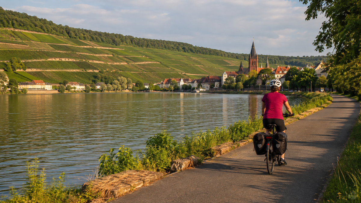
In short: This MainRadweg tour takes you from Würzburg to Mainz in six days. Based on the published stage distances, the six official sections total around 267 kilometers. You follow the Main downstream through the Main Triangle, the Spessart, and the Rhine-Main region to its confluence with the Rhine.
According to the operator, the complete MainRadweg begins either at the Red or White Main and covers 594 kilometers to the confluence. For a week, the western section from Würzburg is more practical: manageable daily distances, clear stage towns, and several rail connections. Nevertheless, the route remains a cycling tour, not a continuous riverside park. Town crossings, changes of riverbank, short climbs, events, construction work, and high water levels may alter the itinerary.

The six-day route at a glance
| Feature | Planning figure |
|---|---|
| Start and finish | Würzburg – Mainz-Kastel/Main confluence – Mainz |
| Distance | Around 267 km according to the six official section distances |
| Complete MainRadweg | 594 km from the route at the Red or White Main to the confluence |
| Duration of this plan | 6 riding days of 34–56 km |
| Direction | Downstream from Würzburg to Mainz |
| Difficulty | Mostly moderate; navigation and the current water level are more important than long mountain passes |
| Navigation | Signage plus official GPX track and current detour notices |
The operator divides the entire route into 13 sections. This plan adopts official sections 8 to 13. The figures are rounded: on individual detail pages, the destination kilometer described may differ from the heading by a few hundred meters. Access routes to accommodation, sightseeing, and detours are not included.
MainRadweg from Würzburg to Mainz: six stages
| Day | Section | Official stage distance | Planning focus |
|---|---|---|---|
| 1 | Würzburg – Gemünden am Main | 43 km | City start, Main riverbank, and transition from the Main Triangle to the Main Quadrilateral |
| 2 | Gemünden – Wertheim | 56 km | Longest day, several towns and short climbs |
| 3 | Wertheim – Miltenberg | 34 km | Short rest day; the detailed description ends at around km 35 |
| 4 | Miltenberg – Aschaffenburg | 42 km | Alternating sides of the river and urban approach to the destination |
| 5 | Aschaffenburg – Frankfurt am Main | 52 km | Wider, increasingly urban Main valley |
| 6 | Frankfurt – Mainz | 40 km | Main confluence, Mainz-Kastel, and onward journey to the selected station |
The complete sequence is documented in the official stage recommendations. For navigation, the operator provides separate tracks for the route starting at the Red and White Main; both also include the western section described here.
Day 1: Würzburg – Gemünden, 43 km
The stage begins at the Old Main Bridge. In Würzburg, the direct riverside path may be closed during festivals or exhibitions; if so, follow the local signs. Via Erlabrunn, Zellingen, Himmelstadt, and Karlstadt, you reach Gemünden. The landscape changes along this section from the wine-growing Main Triangle toward the Spessart. At 43 kilometers, there is time to take the ride out of the city calmly and follow the navigation carefully at the changes of direction in Karlstadt.
Day 2: Gemünden – Wertheim, 56 km
This is the longest day of the week. The route mainly follows the left bank of the Main, passes Lohr and Marktheidenfeld, and reaches Wertheim after around 55.6 kilometers. A detour into a town adds extra distance. Divide the route into two scheduled breaks and refill your water in good time. Short climbs, wind, and summer heat can turn a moderate profile into a long day.
Day 3: Wertheim – Miltenberg, 34 km
The short section is suitable as a recovery day. From the Old Bridge in Wertheim, the route goes via Kreuzwertheim, Stadtprozelten, and Freudenberg to Miltenberg. At the Freudenberg lock, there is the only explicitly mentioned significant climb on this section. The detailed description reaches the Old Bridge in Miltenberg at approximately kilometer 35; the stage heading rounds this to 34 kilometers. Do not plan down to the final kilometer.
Day 4: Miltenberg – Aschaffenburg, 42 km
The route runs along the edge of the Odenwald via Klingenberg, Wörth, and Obernburg to Aschaffenburg. Several bridges and changes of riverbank require attention. A detour to Engelberg Abbey would involve around 130 additional meters of elevation gain and should only be included if time and fitness allow. The official stage destination is below Johannisburg Palace; the ride to your accommodation comes in addition.
Day 5: Aschaffenburg – Frankfurt, 52 km
Beyond Aschaffenburg, the Main Valley becomes broader and more urban. Via Seligenstadt, Hanau, Mühlheim, and Offenbach, you reach the Eiserner Steg in Frankfurt. Although the official text mentions many green riverside sections, expect pedestrians, access roads, and crossings in built-up areas. Ride defensively and allow more time for the final urban kilometers than for the same distance on an open farm track.
Day 6: Frankfurt – Mainz, 40 km
The final stage begins at the Eiserner Steg and follows the Main through the western urban area to its confluence. The official route reaches Mainz-Kastel at around kilometer 40.2. Mainz-Kastel is on the right bank of the Rhine; if your accommodation or train is in central Mainz, crossing the Rhine is also required. Therefore, check before booking which station you actually need and how to reach it by bike.
GPX, detours, and water levels
The official GPX page provides a complete track from the source of the Red Main and one from the source of the White Main. Download the appropriate track before your trip, trim it to Würzburg–Mainz in your navigation software if necessary, and save an offline map. Do not modify the original file without saving a backup, so that you can fall back on the complete track if something goes wrong.
On a river route, flooding is not a minor concern. The operator refers to the Bavarian Environment Agency’s daily flood and low-water reports and also maintains a page with current detours. Check both on the evening before. Flooded or closed riverside paths are not made accessible by a navigation route; use only signposted alternatives.
Arrival and departure by train
Würzburg and Mainz are well connected to the rail network. Additional railway lines run along large parts of the route, which can be helpful in bad weather or in the event of a breakdown. The official travel information mentions the Main-Spessart-Express near the Main between Bamberg, Aschaffenburg, and Gemünden, as well as train connections to and from Frankfurt.
Taking your bike is still not guaranteed. Check each specific connection, any possible reservation, the bicycle ticket, the number of parking spaces, and construction work. In regional transport, ticketing and regulations differ between Bavaria and the RMV area. Do not assume that a bus will carry a heavy e-bike or a bike with wide tires. The official arrival and departure page consolidates current information.
Planning accommodation and charging
Gemünden, Wertheim, Miltenberg, Aschaffenburg, and Frankfurt are the logical intermediate destinations. Choose accommodations near the route so that you do not have to cover additional kilometers every evening. Important features include a dry, lockable bike room, a late-arrival option, and, for e-bikes, an explicitly permitted power outlet. A general statement that a property is “bike-friendly” does not confirm that charging is possible.
Bring the appropriate charger yourself and clarify whether charging will take place at the bike or in a designated room. Never charge in a stairwell or escape route. For daily stages of up to 56 kilometers, many systems should have the necessary range, but weight, wind, assistance level, temperature, and battery condition vary. The tested specifications for your specific bike are decisive, not a general route description.
Preparation: short checklist
- Check the brakes, tyres, chain, lights, and luggage fastenings.
- Save the official GPX track and an offline map.
- Book accommodation with secure bicycle storage and, if necessary, a confirmed power outlet.
- Pack a rain jacket, sun protection, and sufficient capacity for drinking water.
- Carry a pump, spare inner tube or repair materials, and suitable tools.
- Check train tickets and bicycle transport for Würzburg and Mainz separately.
- Check flooding, weather, events, and detours the evening before.
- Allow extra time for town crossings, bridges, and continuing your journey from Mainz-Kastel.
Travel period and planning limitations
Late spring to early autumn usually offers long days and many open businesses. This does not guarantee that the route will be rideable. In spring and after heavy rain, paths near the river may be flooded. In midsummer, heat, thunderstorms, and fully booked accommodation are relevant considerations. In autumn, days are shorter; wet leaves can be slippery. Check official warnings for your travel dates and postpone a stage if conditions require it.
FAQ
Does this tour cover the entire MainRadweg?
No. The complete MainRadweg covers 594 kilometres. This six-day route uses official sections 8 to 13 from Würzburg to the Main estuary near Mainz.
How many kilometres is it from Würzburg to Mainz?
The six published section distances add up to around 267 kilometres. Differences arise from rounding, the journey to your accommodation, detours, and current diversions.
Which section of the MainRadweg is the most beautiful?
The sections from Würzburg to Gemünden and the subsequent river loops are appealing for vineyards and Franconian towns. If you are looking for half-timbered buildings and narrow valley passages, allow more time between Wertheim and Miltenberg. Frankfurt–Mainz, on the other hand, offers the strongest mix of riverside trail, city, and the Main estuary. The best stage therefore depends on your interests, not just the number of kilometres.
Is the MainRadweg flat all the way?
Compared with an Alpine route, it is moderate, but not completely flat. Short climbs, bridges, town crossings, wind, and detours are all part of it. The elevation profile should be checked on the current track before every day’s stage.
Can I ride the tour on an e-bike?
Yes, if your bike is suitable for luggage, the terrain, and the daily distance. Confirm overnight charging options, bring the appropriate charger, and plan your range conservatively. Public charging points are only a supplement.
What should I do in the event of flooding?
Do not ride through closed or flooded sections. Check official water-level reports and official detours, follow the signs, and use a safe rail section if necessary. A GPX track is not a safety clearance.


Share:
Changing bicycle pedals: How to identify a left-hand thread safely
Kocher-Jagst Cycle Route in 6 Days: Circular Tour Starting in Aalen